Mabinogi World Wiki is brought to you by Coty C., 808idiotz, our other patrons, and contributors like you!!
Want to make the wiki better? Contribute towards getting larger projects done on our Patreon!
Osna Sail
Description and Geography
Insert here the clean map of the area, if there is one.
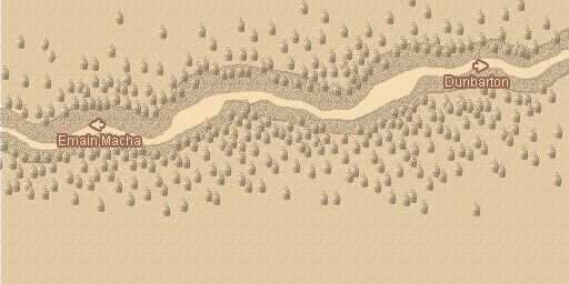
The grassland pathway connecting Dunbarton and Emain Macha.
An alternate route from the grasslands of Sen Mag leading further inland. Although a time-saving shortcut, it is a narrow and dangerous road infamous for numerous wild beast attacks.[1]
Osna Sail is a narrow mountainous passageway between Dunbarton and Emain Macha through the Antrim Mountains. As it directly connects the two cities, many ambitious journeymen take this path rather than taking a long detour through the Sen Mag Plateau. Wolves are seen frequently seen on the path, preying on unsuspecting travelers.
The pathway overlooks a large forest.
There is a high probability of running into Bandits as Osna Sail is a tight passageway, with almost no way to get around them.
Areas of Interest
Resources
| Other | ||
|---|---|---|
| Resource | Obtained From | Location |
| Hitting man-made objects | Along the road | |
Amenities
- None
Facilities
- None
NPCs
- None
Monsters
Areas Connected
- Dunbarton (East)
- Emain Macha (West)
Music
| Track | Title |
|---|---|
| One Way |
Trivia
- Osna is likely the Irish word osna (meaning sigh) or ósna (a contraction of ó na meaning from the) while Sail is likely the Irish word sáil (meaning heel but here more specifically the mountain spur).
- In the first case they would be the Heel of Sighs/Mountain Spur of Sighs though the order of the words is unusual.
- In the second case they would be of the Mountain's Spur.
- Min Kyung-Hun states that "Hill of Sighs" was the intended meaning of Osna Sail during an interview in 2023 while he was Director of Mabinogi.[2]
- Considering the snow-capped mountains, it is possible that the forest below lies not south, but north of Osna Sail, and that the minimap is wrong.
- If this is the case, what the backdrop depicts would be Ulaid Forest and the Mourne Mountains.
Gallery
Notes
| ||||||||||||||||||||||||||||||||||||||||||||||||||||||||||||||||||||||||||||||||||||||||||||||||||||||||||||||||||


